The Uists in Summer

With Christmas upon us, it now feels an age since our summer trip to the Outer Hebrides but the memories remain vivid. Our week staying in a croft cottage on South Uist was spectacular in so many ways and deserved a much quicker blog post but such tasks have been on a back burner this year. Finally, I’ve written the post and, hopefully, the coming year will have many more.

We travelled up to South Uist via a night in Fort William and the CalMac ferry from Mallaig to Lochboisedale.  Our cottage was only a 15 minute drive from the ferry, located in the very far south-west of the island; much further south and you meet the causeway across to Eriskay, from where you can catch the ferry to Barra. 

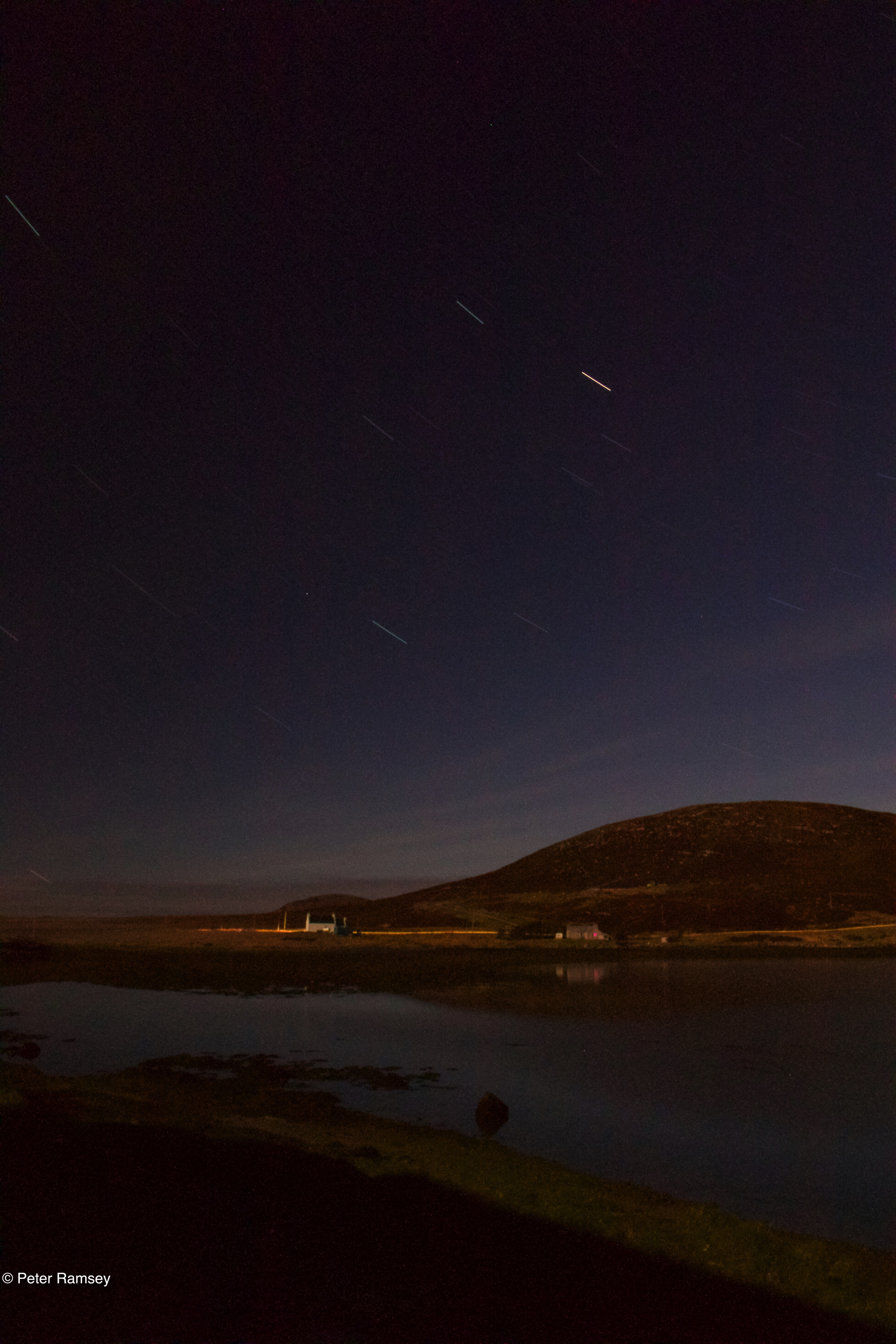
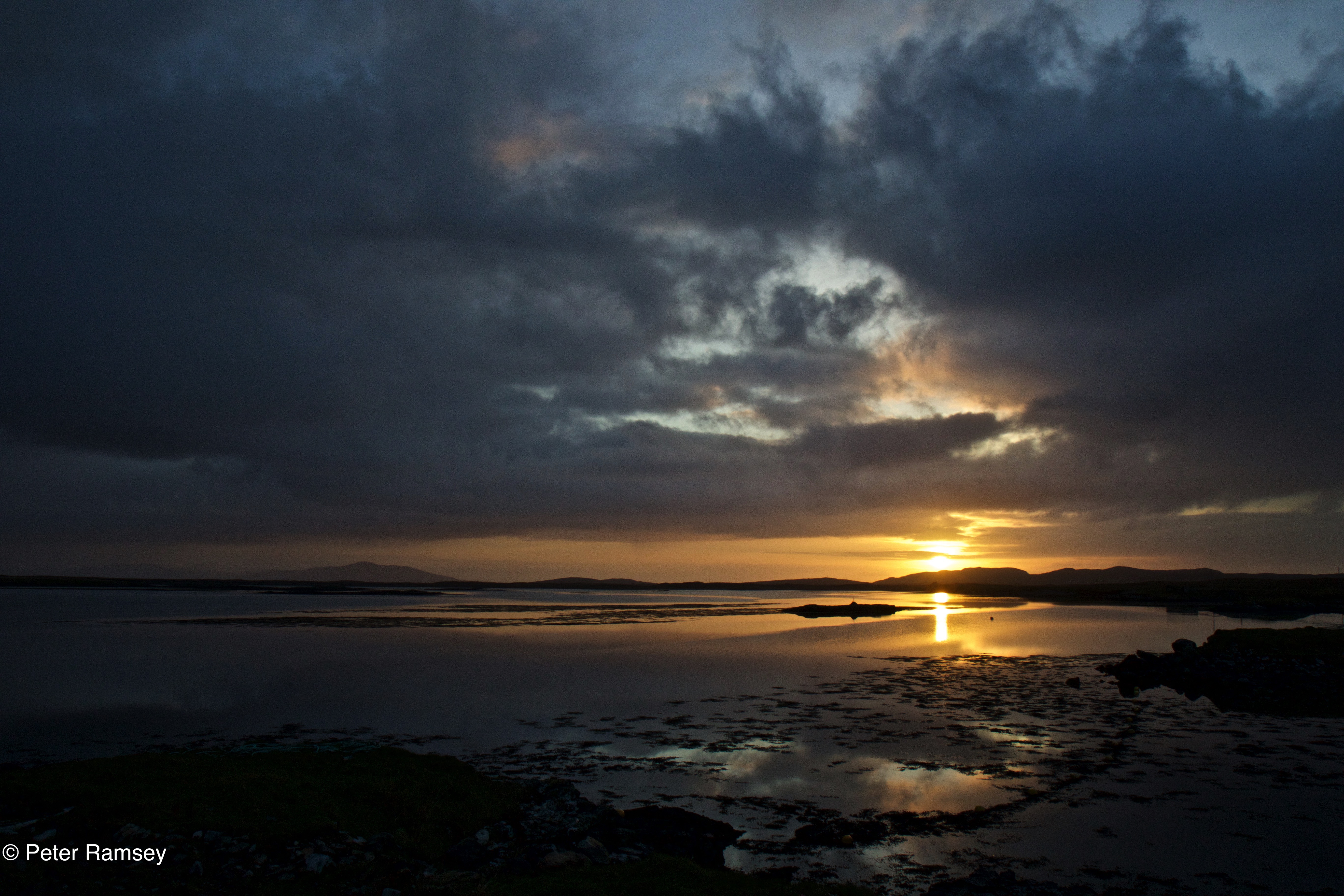
The village where we stayed, Smercleit, like many settlements in the Outer Hebrides, is formed of single homes or small collections of houses, spread over a wide area, rather than more clearly defined villages on the mainland. Our cottage stood alone down a gravel track, set back from two road-front houses and the beach beyond them. It stood on a small island above the surrounding wet pasture, which was dissected by drainage channels and punctuated by small lochans and the remains of old crofts. Looking behind the cottage, the land eventually started to rise into the southern hills between Lochboisdale and Eriskay. They are not high, only 243m at the most and tiny compared to those further up the island; the highest being Beinn Mhor, standing a 620m. Out to the front, looking south west, was the Atlantic Ocean, but with a glancing view of Barra too.

The wildlife of the rich, wet pastureland around the cottage was almost immediately visible. That first evening there was a short-eared owl patrolling in front and around the house and snipe ‘chipping’ in the long grass and ‘drumming’ overhead. Drumming snipe are one of my favourite wildlife sights – the sound not unlike a comb kazoo as the bird drops quickly through the air vibrating its wing feathers. There were other birds too, easily seen with a walk along the quiet road  behind the beach front; plenty of starlings, lapwing, redshank, swallows and the ever watchful and noisy oystercatchers. 

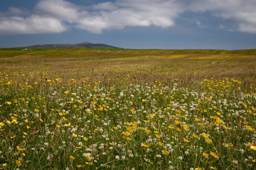
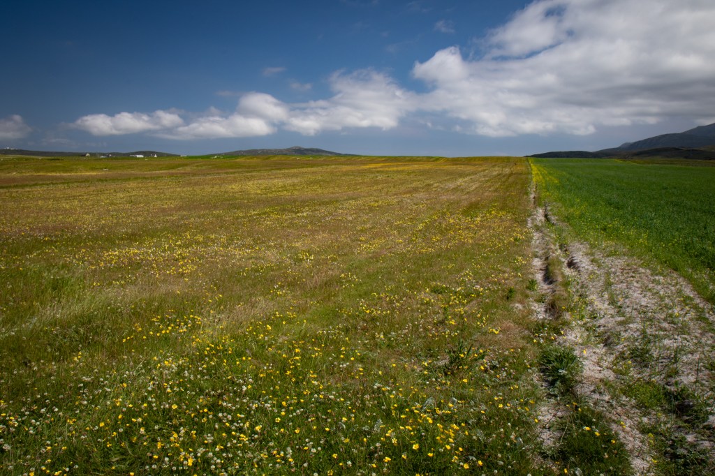
There’s one word that it synonymous with the Outer Hebrides at this time of year: machair. The low-lying sandy and rich coastal pasturelands are at their best in June and July with the scent of their flowers drifting across most of the islands. Away from the damp pasture, the machair coats vast areas on the west coast of the islands with the flowers spreading from the sea to the bottom of the eastern hills and mountains in some places. The land that run at right angles from the central spine road towards the sea put you right into the middle of the scenes with sandy tracks then leading off through the flowers. I’ve visited the islands a few times before but always at the wrong time of year for this seasonal spectacular – this time, at the end of June and beginning of June, we hit the perfect moment for the flowers to be at their peak.

However, the Uists do not just have flowers out on the Machair; the harsher moorland areas were surprisingly rich in flora too. A walk around the national reserve Loch Druidibeag revealed great numbers of orchids, the scale of which I’ve seen nowhere else.

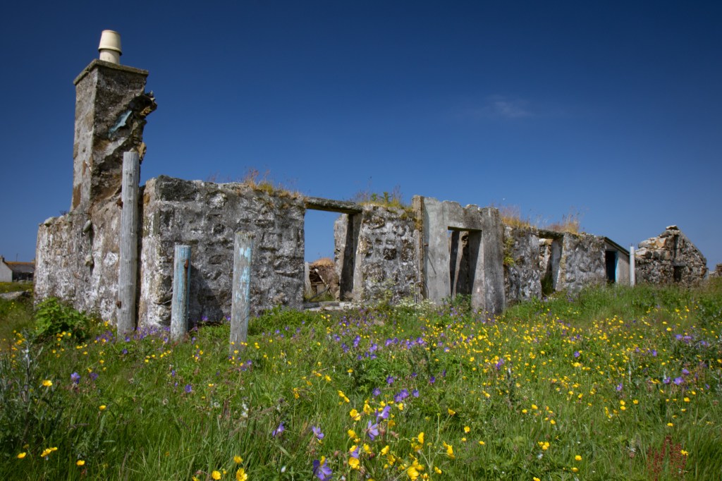
Like so many remote islands, the landscape is dotted with abandoned houses and farmsteads and in the case of the Uists, abandoned vehicles left to decay on the machair. I often feel drawn by the signs of people being taken over by nature and disappearing into the landscape and these islands are full of such sights. Some of the abandonment is very old but even with relatively new vehicles left out in the fields, nature hasn’t taken long to take control, with a few becoming homes to small flocks of starlings. 

As with most of my trips, watching wildlife was a big part of the experience. Many of the birds we saw may have left the area now, replaced by winter visitors or other passing through on their autumn migration from the high north. 

There was one particular summer visitor to the islands I’ve wanted to see for many years but they can be particularly challenging. Gone from the vast majority of their former range, populations of concrakes hang on in some of the Scottish islands and the Uists are a particularly good place to find them. We were driving down a single track road one sunny lunchtime when we saw partridge-like birds walking along the road. We immediately knew what they were and as we came to a halt, they jumped into the long road-side grass. However, they didn’t go far and were quite obliging in providing us with very close views from within the car. We eventually got out but they slinked off further into the long grass, not to be seen again. 

That wasn’t the last time happened upon them. We didn’t see them again but we heard them several times at the RSPB’s Balnarald reserve and while out walking along an area of Machair – the video below recorded their instantly recognisable call.

We saw 75 species of bird over the course of the week with plenty of species of note. We particularly went to see those species of the remote areas of Scotland; those of the moorland, the lochs and the sea. There were red-throated divers, eiders, Manx shearwaters and storm petrels, there were white-tailed eagles, hen harriers and peregrines, dunlin, common sandpipers and curlew, and there were arctic and little terns, and great and arctic skuas, and twite and wheatears. All in all, a great range of birdlife amongst quite spectacular scenery.

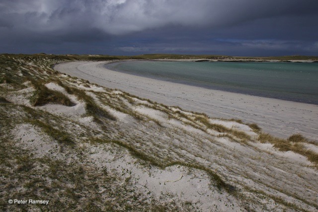
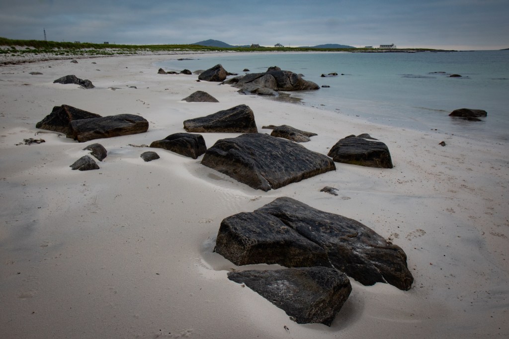
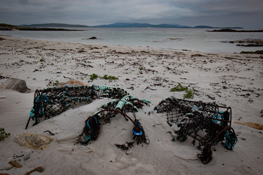
Perhaps the most spectacular of all the scenery is down on the coastline. The Uists are home to some of the most fabulous beaches in the UK and, for the most part, even in summer, you may find you have vast areas of sand to yourself. We were very lucky on the days we went for beach walks in that the sun shone strongly with very little breezy giving fairly balmy weather for the Outer Hebrides. 

The Uists, North Uist and South Uist with Benbecula in the middle, are 54 miles, or just under 1.5 hours to drive north to south. Staying at the very bottom of the islands, it was a long drive to the top each time we went and I’d perhaps suggest it’s better to stay in the north of South Uist or the south of North Uist, to provide better access to the islands as a whole. For me, Benbecula perhaps has less to offer in wildlife and scenery terms but it well worth a look around and certainly should just be pass through on route between the Uists. In fact the causeways that join the three islands together are good places to see wildlife from, although our otter targets never appeared when we were looking.  

Overall, if you like remote islands with few other people around, beaches to yourself and scenery and wildlife to linger long in the mind, the Uists need to be on your holiday list.

Outer Hebrides: A day on Mingulay

I’m so far behind my blogging at the moment that I’m writing a post about a previous holiday when actually on the next one. This current trip follows on from so many now to the west coast of Scotland; a place I’ve grown to love for its remote and stunningly beautiful islands. Sat inside sheltering from wet and blustery autumn day on the Isle of Skye, it’s seems hard to write about a summer’s day back at the beginning of July – although that day did have a hint of autumn about it, come to think about it.

Staying on the Outer Hebridean island of South Uist for a week, we wanted to take a boat trip to an even more remote island. There are a few to choose from including St Kilda but we decided instead to go to Mingulay at the southern tip of the archipelago (only Berneray is further south).

First we had to make a 40 minute ferry journey between Eriskay (joined to South Uist by a causeway) and Barra. Usually this crossing of the Sound of Barra would have provided great views of the islands but due to COVID-19 restrictions passengers had to stay within their cars for the entire trip. Not that walking around the ferry would actually have given us much of a view, however, as the clouds on this summer day were shrouding the ferry and the surrounding sea and land.

On arrival on Barra, we drove one half if the road that loops around the island and arrived in the main town of Castlebay still cloaked in cloud. This didn’t look promising for our trip but as we waited at the small marina the cloud started to lift a little; the gloom remained but it didn’t obscure every view.

We were welcomed aboard ‘Spirit of the Hebrides’ by the Hebridean Sea Tours crew for 30 minute from Barra to Mingulay. The boat was comfortable and stable as it powered across the open sea, helped by the good conditions. The water was almost bubbling with birdlife all the way to the island with auks, cormorants and gulls flying in groups or fishing alone on the surface. There were lines of gannets too, skimming low over the sea and we had a glimpse of a possible albatross tagging on to the back of one of those groups.

As we neared the island, we entered Mingulay Bay and moved slowly over towards the rocks on the northern tip of the beach. Anchored to the seabed, the boat sat still as the crew unloaded an inflatable at the back and half the passengers disembarked and were taken across to the shore, making the sometimes nervy step onto rocky land. We immediately headed up the grassy slopes above our landing place to seek out the puffins. Once halfway up the hillside we sat and waited for them to come in to land. They almost immediately started to appear but flew onwards, both above and below us, and sometimes straight past our heads. It took a while for them to get confident to land with people close by but eventually they were popping into and out of their burrows all around us.

After a while, we decided to take a wander down to the beach and up to the abandoned village. The island has no resident population after the final permanent inhabitants left in 1912. The island was not cleared like so many old communities around the Highlands and Islands; this was a much later and voluntary, if to some reluctant evacuation, when the last remaining families decided that a better and easier living could be made elsewhere. Mingulay was a tough place to live and as numbers dwindled the living became even harder. Other nearby islands had natural harbours and landings from which to load and unload boats; Mingulay does not and could be cut off for months at a time.

I find the old abandoned islands and villages of Scotland, as can be seen in some of my other posts, fascinating and hugely magnetic. There is something I can’t quite explain that draws me to them. I find silence where communities used to thrive, or survive, is almost tangible. There is a spirit to these places where the human past is being claimed by nature as the signs of former habitation slowly melt into the landscape.

The island around the bay is one large amphitheatre with four peaks along its outer edge. The sandy beach at its centre, on a clear day, reflects turquoise up through the lapping water but for most of our four hour stay, the sea remained a dark steel blue grey. Occasionally, the sun would start to break out through the dominant cloud to reveal the true colour of the bay but it was soon obscured again as the cloud got its way. As we sat having our lunch by the old school house, a sailing ship came in to moor while we were distracted by the old village, giving the island an even greater feel of times long gone

All too soon, the time had come to return to the boat but having made a more confident return by the inflatable, we didn’t sail straight to Barra but had a tour around the other side of the island, unseen as we approached in the morning. Away from the green eastern-facing slopes of Mingulay, the island is rocky with high, precipitous cliffs, towering dark and foreboding over passing boats and ships. I’ve seen quite a lot of sea cliffs around the UK and further afield and Mingulay has some of the most spectacular I have been fortunate enough witnessed. They seem almost endless at times and so steep that you have to be careful not to fall backwards as you stare vertically upwards. They are covered in seabirds from guillemots and razorbills, fulmar and kittiwakes to shags, cormorants and puffins. The cliffs are patrolled by gulls and great skuas picking on unsuspecting nests as they pass. Just as we left the island behind a white-tailed eagle appeared and made is purposeful way along the cliffs looking for its next meal.

The sights, sounds and smells of the cliffs were a spectacle like few I’ve seen and the cliffs made all the more ominous by the dark looming clouds above. As I’ve written before of other sea cliffs, these are probably not the spectacle they once were with many seabird populations in serious decline compared to the historical scales but it was a privilege to see such a place while such large numbers of birds are still there.

Just to add to the great day, the cliffs were not the last spectacle. As we made our way back to Castlebay, we were joined by a pod of common dolphin, playing in our wake and riding the waves alongside us. They were distant at first but as we slowed, they soon caught up and we had a good ten minutes of action. Unfortunately, we had eventually to leave them behind and return to the marina – some of us had a ferry back to Eriskay to catch. 

As we retuned to the ferry slipway and waited for our crossing, the sun started to break through the cloud and patches of the Sound of Barra took on its stunning turquoise shimmer. In the distance, the were grey seals hauled up on sandbanks and we could hear their eerie calls washing over the water – quite a lovely way to end a day in the wilds of the southern Outer Hebrides.

P.S. Whilst this post is really about the Mingulay and it’s wildlife, I can’t not mention that up on that grassy slope watching the puffins, I proposed to my girlfriend, Sarah, and got a positive answer! Mingulay will therefore always be an even more special place to us and this gives us another reason to return in the years to come.

A Hebridean ferry crossing

We’ve just got back from a week’s holiday on South Uist in the Outer Hebrides. Hopefully more blog posts to follow but I had to write about the ferry crossing on the way home; I don’t think I’ve had a more lovely one!

We caught the very early morning ferry from Lochboisdale to Mallaig, getting up at 4:30am to pack the last bits into the car and make the 15 minute drive to the port. The day started dull and cloudy but as the ship (the Lord of the Isles) pulled away the sun started to break through the cloud, although the thick haze never lifted completely. The Sea of the Hebrides was as flat calm as I ever recall seeing open water. The ripples weren’t strong enough to break the surface and it had taken on a liquid glass appearance. This meant that we could see far further across the water than normal and the wildlife wasn’t obscured behind waves as it so often is; even individual birds hundreds of metres away could easily be picked up with the naked eye.

Having seen cetaceans before in this sea, including on the way across at the beginning of the week, I was hoping for more and there was no disappointment. We saw common dolphins four times during the crossing and a couple of pods of porpoise. The dolphins were leaping clear of the water as they chased across the flat calm sea while at times they circled around catching fish. The porpoise, however, we more subdued in their movement, simply breaking the surface and rolling down again, often barely noticeable. 

The birds were equally special. At first there was some arctic terns slowly flying out to sea but there were many more birds to come. I saw my first ever storm petrels, as they darted swallow-like, close to the surface of the sea. I’ve helped to install nest boxes for them but never seen one before – they were lovely and so much easier to pick out against the calm waters.

More spectacular were the Manx shearwaters. Large flocks of them sat on the sea, feeding on the surface but they lifted almost swarm-like as they were harried by the skuas after their catches. They raced across the water, escaping their tormentors and eventually settled back on the surface again.

The were groups of other seabirds, often gulls and fulmar, fishing around concentrations of fish, with gannets plunging in from above. There were also auks everywhere; individuals fishing, sitting on the surface and long chains of birds racing across close to the water. We saw guillemots, black guillemots, razorbills and puffins for much of the way across, often dipping below the surface as the ship passed by.

All the sea life was laid out in front of the stunning backdrop of Skye and the small isles (Canna, Rum, Eigg and Muck) as well as the Outer Hebrides disappearing in the mist behind us.

I generally love a ferry crossing but this was was spectacular!

Isles of Harris and Lewis: A walk on Luskentyre Beach

Pulling the door firmly closed behind me, I leave the cottage and am buffeted by the keen wind as I move away from the shelter of the building. It was warm inside but now out in the open there is a chill and the breeze cools me as I make my way down the gravel drive to the narrow single-track road. I cross to the gate, lifting the latch and pushing through, closing it behind me again. Down the grassy slope alongside rows of headstones spaced across the short-clipped lawn of the graveyard. All around the gulls are crying their screeching calls, chasing each other and playing in the turbulent air. I approach the second gate, going through, but struggling to close it properly, the two parts not lining up until finally the metal clank of the latch slots into place. 

I’m now out onto the dunes, pale, almost white sand held in place by tall stands of beach grass. In amongst the rolling hills are two grazing ponies, one grey, one white, their long pale manes and tails being gathered up by the wind. One looks up as I pass but it soon returns its head to the grass, pulling another mouthful and slowly chewing away. The going is soft but down a slope I’m soon onto firmer ground of the beach. There is crunching beneath my feet as I step on a shell-covered surface and I have to shade my eyes as the sand blows across the flat open expanse. I turn away and make for the headland with my back to the onrushing wind. Out here, the sands are of differing shades, yes, there is the pale cream and white but there is also steel grey and black mingled in amongst. The wind has created swirling patterns from the different shades, a myriad of shapes set only for a few hours before they are covered by water and eventually renewed with different patterns.

The tide is on its way in but it is slow running and there is still an hour or more until it is at its height.  Depending on the day its waves can break all the way up to the base of the dunes or it can fail to take away the footsteps of the day. As the water spreads across the low flat sands, piping oystercatchers stand as its edge, gradually moving closer inland as the waves slowly make their way towards the land. Sanderling and ringed plover also forage at the water’s edge, scuttling to and fro with the movement of the waves. They take to the air as I approach and drop down a little way further along the beach. They lift several times as I make my way along the water until eventually tiring of my presence and arching around me to move back to where I first met them.

The footing is firm down by the water, the sand made solid, some of it rippled, some of it smooth. I turn past the headland and the wind drops, the waves take over as the dominant sound; this part of the beach is met with strong forces of the sea with great breakers rolling into the sands. A large log is being rolled up and down as each band of rushing water meets the land. The bark has been stripped away and the revealed wood has been worn smooth by this same action over uncounted days.

Behind the beach, the land rises steeply to a peak and as the air rushes up the face of the mountain it condenses, creating great billowing clouds that trail inland. With the light from the dipping sun shining orange on the slopes, the land looks to be alight with flame and plumes of smoke.

Looking out to sea, Taransay looms large but further behind are the great hills and mountains of North Harris, a line of splendid peaks spreading off into the cloud-filled distance, their summits obscured. The sea between me and the far off coast is simmering with the wind, white water breaking away from the beach. As the waves peak, momentary glimpses are seen of rafts of duck, scoters and long tails floating out the winter in relative shelter of the great bay, their calls occasionally being brought inshore on the wind. I listen out for the wildest sound, the divers, but there are none to be seen or heard.

As the sun drops slowly behind the off-shore island, the shadow creeps up the beach, turning the steel shaded sands to a deepening blue and the gold into caramel. Finally, even the top of the peak it unlit and the darkness creeps in, brought on more quickly by the gathering rain clouds. There is one last pattern in the sand amongst the prints of man and dog; unseen a wilder animal walked along the beach, an otter searching along the water’s edge, gone now but its feet and tail gave it away.

I turn for home, up the narrow stream-bottomed valley and up and out into the open, past the small lambing fields. There are the first drops of moisture on the ever strengthening wind and I have to walk more purposefully to counteract the gusts. Eventually, I come back to the view from the cottage, overlooking the cemetery and vast sands beyond.


Isles of Harris and Lewis: The Coffin Road

The land is bare, like in one great sweep a giant hand has wiped away the trees. Bare, cracked rock dominates; the meagre soil that clings on in between the great slabs of stone supports only tough grasses and spindly heather. Spring has yet to reach these parts, out in the extreme far north-west, the islands on the edge, the lands with nothing between them and the new world. In the early summer, the machair is resplendent with flowers and in the autumn the heather blooms across the hillsides, but now, it is a scene of dull browns, made darker by the low, dense cloud hanging heavy over the hills and glens.

On the east of Harris, a small collection of houses intermittently lines the narrow bay. Out on the edge of the water, one of the boulders, tumbled down from the slopes above, has a common seal dozing atop, almost unnaturally straight when a sprawl would seem more comfortable. The wind is light and there are only the merest of ripples on the loch’s surface, a few paddling birds dot around, too far away to distinguish. 

There seems to be a little living to be had here, fishing but not much else; they were sent here from the more fertile west, banished in favour of sheep. The ground is so thin and poor that little grows here but at least there is shelter, protection from the worst of the winter storms surging in from the Atlantic west. But survive here they did, for decades, they lived off the plenty of the sea and what they could meagrely derive from the land.

However, when survival came to an end, as for each one, in turn, it did, they had to return west to be sunk into the deeper ground, so shallow was the soil in the east. Their last journey was across the narrow pass, a rise between the two sides of the island, from the barren to the rich, a reversal from life to death.

The final journey was by hand and by shoulder, starting in the village and ascending up the slopes and through the high valley. There was no well worn path, just rock, stream and mire. The struggle in life became a struggle through death for the bearers, but bear it they did. The solemn procession stumbled, sank, tripped and drenched their way up through the sodden pass. With death coming more in winter than in summer, the task of taking the Coffin Road in the darker, colder, windier months, must have been harder still and some of the dead, so it is said, didn’t make it to the other side, planted on the way, where the depth of the soil allowed.

On cresting the last rise, the view opens up and down below, further still, lie the vast, effervescent sands of Losgaintir. Now, the westerly wind would hit them with full force, pushing their heads lower as they struggled to keep their feet on the uneven ground. Downward they would trudge, still no path and still only treaterous footing beneath. The miles were few but long and energy sapped as the hill began to flatten out and the ground became firmer. Alongside the bay, the procession continued around numerous small headlands until, at last, the cemetery came into sight. Only now for the empty shouldered trudge to return over the hills, with the gulls incessant calls at their backs to hound their departure from their former lands.

The first walk I did in Harris was one I had planned to do when I stayed in North Uist a couple of years ago; there’s a ferry linking the two islands but I didn’t get round to going across for the day. I used the excellent Cicerone book ‘Walking on Harris and Lewis’ as my guide – this is one of a vast series of great books covering many locations with detailed directions and an Ordnance Survey extract for each walk. As I was staying at Luskentyre, a good two and a bit miles from the route, I decided to start from my cottage and extend the walk from almost nine miles to nearly 14. The day started off bright but as I walked along the undulating and twisting road, the cloud closed in with a slight hint of moisture in the air. Joining the route at the far end from the suggested starting point actually made sense to me as it saves the best bit to last and it also gets what is a bit of a unpromising traipse along the route of the former main road between Tarbert and Leverbrough.

Once off the road, you drop down a side road into the old township of Aird Mhighe, the starting point for the Coffin Road. From here there is now a good path all the way across, laid with gravel in places and stone channels for the frequent streams; there are also marker posts at useful intervals. It’s not a particularly hard walk now, relative low-lying compared to many of the mountain walks further north but it’s easy to see how those coffin-bearers would have struggled all the way across without the modern path. There is certainly a sense of desolation as you get to the top of the pass, nothing in sight apart from rocky and marshy hillsides. However, without a solemn duty myself, cresting the last rise through the pass was a delight as the Luskentyre sands were laid out below. The sun had come out as I walked up the track and it dazzled as the tide had gone out to reveal the sands of differing shades of gold, cream, steel. The water, as it laps across the beach is of the most incredible colours, ranging from dark blues and greens to an almost electric turquoise. Heading down the hill as the Coffin Road comes to an end is on a better made track and eventually meets the main north-south road again. I crossed it and walked back along the lane to Luskentyre – views of the beach and its bays all the way home. 

IMG_8051

North Uist: Post-Dusk Chorus

Standing on the doorstep, the moon shining down and lighting up the nocturnal world, it is my hearing that draws attention not my sight; silence but for the birds.

Sheltered from the strong wind but it has ceased and I walk out, crunching on gravel, to the edge of the plot. Overlooking the low, shallow bays, I listen to the post-dusk chorus.

There’s a nervous lapwing out in the dark, wary around its nest and the skittish redshank piping alarm at some movement on the shore.

Further from the water, a harsh growl is let out by the short-eared owl and the snipe drums its wing feathers as it floats to the ground. Back to the sea and the oystercatchers join the lapwing and redshank in calling at an unseen peril.

The sounds of the wild are completed by the mournful curlew as it lifts and glides off into the distance, its crying echoing around the bays.

5R0A6499

North Uist: A Day Exploring

My first full day on North Uist and I spent it travelling around the island and getting my bearings. It’s not a huge place, so after a day spent driving and walking, I’m already familiar with the geography.

One of the main reasons I like to come to places like this is for the remoteness and lack of the hustle and bustle of my usual working week in the centre of Manchester.  However, today was exceptionally quiet.  There were very few people about and I didn’t come across many cars – maybe it’s always like this; I’ll have to wait and see tomorrow!

I spent the morning at RSPB Balranald, out on the western coast of the island.  It has contrasting landscapes with wide, open and flat pasture, sandy beaches and rocky shorelines.  The weather out there changed by the minute; to-ing and fro-ing between rain and bright sunshine, the strong wind blew clouds over so quickly that it was difficult to keep up!  The rain didn’t spoil my visit, however, and I think the weather is all part of the experience and certainly made it memorable.

5R0A2602

I’m a bit early in the year for some of the highlights at the reserve such as rasping corncrakes and the wildflowers of the Machir but I did get some good views of the local wildlife and passing migrants.  There were flocks of golden plover moving from field to field, a couple of great skuas flew along the coast and a small group of barnacle geese lifted and headed north as I rounded of the shoreline.

5R0A2673.jpg

After walking along the white sand beaches of the reserve, I headed off on more wanderings around the island and came across the chambered cairn and standing stones at  Beinn Langais.  I walked up to the cairn, then to the top of the hill and round, back via the standing stones, with the weather just as changeable as it was in the morning. From the top of the hill, despite the cloud, there were great views across much of the island and down to the south towards Benbecula and South Uist; on a clear days the sights much be amazing.

5R0A2772.jpg

For the last part of the day, I travelled across the minor road that almost splits the island in half (well, more like one third to two thirds) and then headed up to Berneray to what the landscapes were like in the north.  I wasn’t disappointed as the beaches, hills and small lochs were just as photogenic as they were elsewhere during the day.

5R0A2808.jpg

Today has certainly whetted my appetite for more wanderings around the island.  After a guided wildlife tour tomorrow, I’ve got a few ideas of where to visit next. I certainly want to visit the islands to the south but there’s so much more to do on North Uist that I may not get around to going to Harris and Lewis at all – perhaps that’s another trip up here already in the planning!